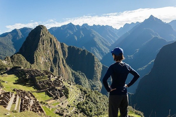
The Choquequirao trek provides the opportunity to visit two ancient Incan sites. Trekkers will get to see the famous Machu Picchu, but also Choquequirao as well.
Choquequirao is an ancient Incan city known as the ‘Cradle of Gold'.
In this article, I will describe the Choquequirao trek to Machu Picchu, which is a challenging and fantastically beautiful adventure. In addition, it is a unique alternative to the busy Inca Trail.
Read on to learn more about the fascinating Choquequirao Ruins and how to reach them. This is the ultimate guide on everything you need to know about hiking the Choquequirao trek.
Get a trek quote
Start planning your trek to Machu Picchu today.
Choquequirao Trek to Machu Picchu
An Overview of the Choquequirao Trek
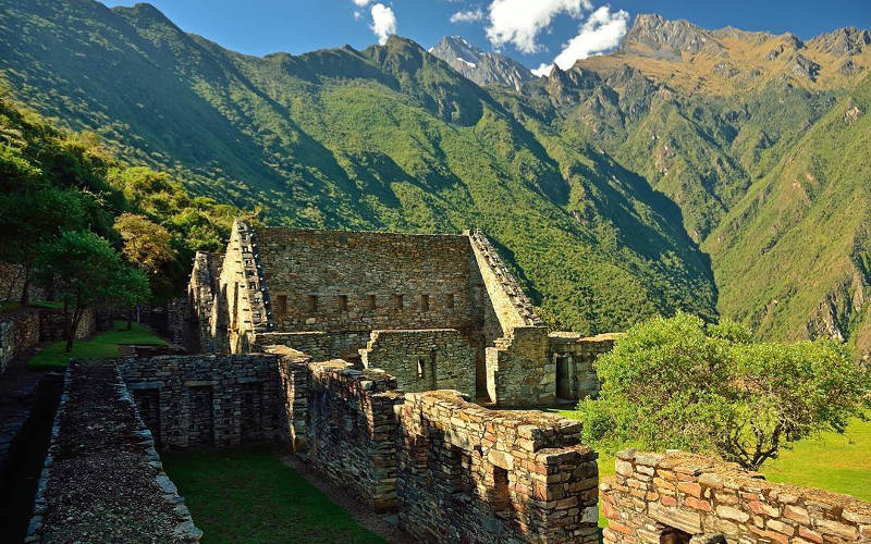
Choquequirao is an Incan City ruin that is located at 3,150 meters (10,334 feet) above sea level. The site has a very similar structure and architecture to Machu Picchu and it is well worth the visit.
How Long Is The Choquequirao Trek?
The classic Choquequirao trek is nearly 60km (37.3 mi) spread over 5 days, with the third day spent visiting the famous Incan ruins while the fifth and final day is spent returning to Cusco.
For the rugged adventurer, you can hike Choquequirao and continue on to Machu Picchu. This is an epic 9-day adventure which covers over 100km / 65 miles! You will need ample time and energy, so make sure you do lots of training before your trip.
For trekkers who have already visited Machu Picchu, the Choquequirao trek can be completed as a standalone hike. Unlike the Inca Trail, it does not require a permit or guide.
How Do You Get To Choquequirao in Peru?
Choquequirao in Peru can only be reached by hiking for 2 days from the towns of Cusco, Cachora, Huanipaca, or Yanama. Almost all commercial Choquequirao treks start from Cachora or Cusco.
There are plans for the construction of a cable car that will carry tourists to the city’s Citadel. This project is a priority for tourism development. Construction is set to commence in 2022. Whether this will happen or not is yet to be seen. With this in place, it is estimated that thousands more people will visit Choquequirao each year.
For now, the site remains largely hidden from tourists. This provides a unique experience for hikers wanting a little exclusivity on their Peruvian trek. Seeing Choquequirao is an exclusive privilege for those willing to hit the trail.
A Brief History of Choquequirao
Choquequirao can be translated to ‘Cradle of Gold’ in the Quechua language. This Incan City was built during the late 15th and early 16th centuries.
It is thought that Pachacutii founded Choquequirao. This same Incan emperor was responsible for commissioning the construction of Machu Picchu too.
The city was then passed on to Pachacuti’s son, Tupac Inka Yupanki. Under his reign, Choquequirao was extended and re-modelled.
The site is located above the valley of Apurímac river, which is 98km (61 mi) from Cusco. It is situated within Province La Convención in the Willkapamba mountain range.
The Choquequirao ruins cover an area of 6 square kilometers (3.7 square miles). Restoration of the site began in the 1970s and still continues today. As of 2014, nearly 50% of the site had been excavated.
Choquequirao Route Options
The Choquequirao trek to Machu Picchu has a number of route variations. Treks can last anywhere between 4-10 days. The itinerary set out below is for a 9-day Choquequirao trek to Machu Picchu.
Please Note: There are also options to do standard treks to Choquequirao. These options include land transport to Machu Picchu. For more information, check out the Alternative Choquequirao Treks section below.
9-Day Choquequirao Trek- Typical Itinerary
Day 1: Cusco - Cachora - Chiquisca
The trek starts with a 4–5-hour drive to Cachora (2,902m / 9,521 ft). On the way, many tour operators stop briefly at Sayhuit, which is just south of Cachora. Here, visitors can view an incredible boulder carved by the Incas (see image below).
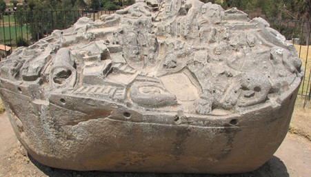
Sayhuite, just south of Cachora, has a fascinating history and wonderfully preserved Incan carvings.
Some operators even arrange for overnight stays at Cachora. This lengthens the total tour by a day, but does provide some respite after a long drive from Cusco. Typically though, tours have lunch and meet their support team and mules in Cachora.
The trek involves a two-hour hike through the Apurimac Valley to Capuliyoc (2,894m / 9,495ft). This is followed by a steep, three-hour descent to Chiquisca (sometimes written as ‘Chiccisqa’) campsite at 1,900m / 6,233 ft.
Total Hiking Distance: ±19km / 12 miles
Please Note: Some companies walk an extra hour to camp at Rosalina Beach.
Day 2: Chiquisca - Choquequirao
From Chiquisca (1,900m / 6,233 ft), you will wake early and descend further into the valley. After approximately 1 hour of trekking, you will then cross the Apurimac River.
Once you have crossed the river, you will begin a two-hour ascent to Santa Rosa. This is a small campsite where you can rest and refill water bottles.
From Santa Rosa, you will continue ascending, with your first stop at Marampata (2,850m / 9,350ft). Then, you will stop for lunch in Marampata and then head to your campsite just below Choquequirao (3,150m / 10,334 ft).
The trek between Santa Rosa and Choquequirao takes between 4-5 hours and is pretty tough. However, there are bathrooms and cold-water showers available at the Choquequirao campsite, which are very refreshing after a strenuous trek.
Total Hiking Distance: ±12.5km / 8 miles (7-8 hours)
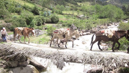
Trekking mules and their arrieros (muleteer) at the back.
Day 3: Choquequirao (full day at the ruins)
The archaeological complex of Choquequirao is very large. It can take a full day to explore properly. Archeologists have divided the site into 12 sections.
Your tour operator will most likely provide a tour of the Citadel. Make sure you also visit the ceremonial center, main platform, and the lower plaza.
Towards dusk, look to the skies for condors as these impressive birds frequent this region.
Total Hiking Distance: ±4km / 2.5 mi each way from camp to the ruins
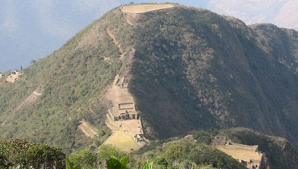
A small part of Choquequirao, showing the truncated hilltop in the background.
Day 4: Choquequirao - Rio Blanco - Maizal
Day 4 starts early with a gradual hike up and over a pass at 3,300m / 10,827 ft. The trail then descends into the Rio Bianco Valley (1,910m / 6,270ft).
At the foot of the valley is the river Rio Bianco where trekkers can take a refreshing swim. You end the day with a tough and steep 3-hour hike up to Maizal (3,000m / 9,840ft).
Total Hiking Distance: ±15km/ 9.3miles (5-7 hours)

Get a trek quote
Start planning your trek to Machu Picchu today.
Day 5: Maizal - San Juan Pass - Yanama
Day 5 starts with a long climb up to the old silver mines at La Victoria. This is the highest point you will reach on the San Juan pass (4,200m / 13,780ft).
Along this way, you will see the original paved Inca Trails. Once over the pass, you will descend down towards the small village of Yanama (3,800m / 12,470ft). This will be your camp for the night.
Total Hiking Distance: ±13km / 8 miles (6-7 hours)
Please Note: With route variations, some companies end trekking at Yanama. They then continue by bus to the town of Santa Teresa. This skips Day 6 and Day 7 of the traditional Choquequirao trek.
Day 6: Yanama to Totora
Day 6 begins with a climb up to the Yanama Pass (4,668m / 15,315ft). This is the highest point on the trek. From the pass, the trail descends to another small village called Totora (4,100m / 13,450ft).
You will camp and sleep here at Totora for the night – the highest point on the trail. Thankfully, you should be well acclimatized by this point.
Total Hiking Distance: ±12km/ 7.5 miles (6-7 hours)
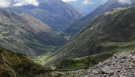
The view near Yanama Pass.
Day 7: Totora - La Playa
Day 7 involves a long and winding descent of nearly 2,000m / 6,562 ft to the Totora River. On this day, you will appreciate having some trekking poles. They are excellent for reducing the impact on your knees as you zig-zag down the valley. (see our Inca Trail packing list for details on trekking poles).
From the river, the trail ascends slightly towards the village. Your campsite is in the relatively busy town of La Playa (2,400m / 7,870ft). You may also hike a little further to Santa Teresa for more peaceful accommodation options.
In this area, there are a lot of options for coffee tasting. It's the perfect place to buy a bag of freshly roasted beans to take home. Your company may also offer a trip to the nearby hot springs. This will be at an extra expense though (around 50 soles).
Total Hiking Distance: ±15km / 9.3 miles (6-7 hours)
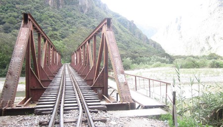
The route along the railway from Hydroelectric Station to Aguas Calientes.
Day 8: La Playa - Hidroelectrica - Aguas Calientes
From La Playa, some tour operators take local transport to Lucma, which is about a 20-minute drive. If no transport is available, then the route can be hiked on foot.
From La Playa, the trail ascends for about 2.5 hours. Again, you will be tracing some original Incan steps during your climb.
At the top, the path splits. It is worth a short to make a detour on the left fork. In minutes, you will have an amazing view of Machu Picchu. Not all companies take this ‘view option’. Look out for the sign that says 'Shortcut to Machu Picchu'.
From the top, it is around a 20 minutes' descent to the Llactapata ruins. This site is still mostly covered by dense vegetation.
The trail descends steeply for 2 hours to the suspension bridge at the bottom. You will pass a spectacular waterfall on the way to Hidroelectrica.
Most trekkers catch a train from Hidroelectrica (1,890m / 6,200 ft) to Aguas Calientes (2,050m / 6,725 ft). One can also walk the 10km route along the rails to Aguas Calientes, which takes approximately 2 hours.
You will stay overnight in one of many comfortable hotels in Aguas Calientes. You will have a second opportunity to bathe in the hot springs. Fair warning, these are often overcrowded with tourists and trekkers. It’s much better to visit springs at a quieter location.
Total Hiking Distance: ±16km / 10 miles (8 hours). This increases to ±26km / 16 miles (10 hours) if you don’t take the train.
Day 9: Aguas Calientes - Machu Picchu - Return to Cusco
Day 9 starts early with a short bus ride up to Machu Picchu if you still have the energy and are not afraid of heights. There is also an option to walk from town. This will take you 1.5-2 hours straight up a steep stairway. This is no joke after 8 days of hiking!
From here, most operators offer 2-3 hour guided tours of the city. Climbing Huayna Picchu is highly recommended. That is, if you aren’t completely gassed from all the hiking you did before then.
Huayna Picchu is the highest peak and is located just behind the citadel. The climb is steep and a little challenging, but the views of Machu Picchu from the top are super rewarding.
There are only 400 permits a day issued for Huayna Picchu. You need to book well in advance. Most operators request that trekkers meet back at Aguas Calientes around mid-afternoon. It is essential that you are on time for the train back to Cusco.
See more in our guide on the best modes of transportation for getting to Machu Picchu.

Get a trek quote
Start planning your trek to Machu Picchu today.
Alternative Choquequirao Trek Itineraries
There are a number of alternatives to the Choquequirao trek. Here are three of the most common ones:
- Standalone Choquequirao Trek
- Vilcabamba and Choquequirao Trek
- Vilcabamba, Espiritu Pampa and Machu Picchu Trek
Standalone Choquequirao Trek
The standalone Choquequirao trek is ideal for trekkers who have already seen Machu Picchu. This makes it a destination-specific hike to the Choquequirao Incan site.
The trek lasts anywhere between 3 and 5 days. It depends on how long you want to stay at Choquequirao. It is possible to take land transport to Aguas Calientes when you return.
Vilcabamba and Choquequirao Trek
The Vilcabamba and Choquequirao Trek is also ideal for those who have already seen Machu Picchu. This combo-trek is super quiet and perfect if you want a unique hiking challenge. You’ll need to set aside 7 or 8 days to complete it.
The trek is shown as the green line on the map above. You can start from either the Cachora side in the south or the Huancacalle side in the north. The scenery on this route is amazing!
The great thing about this trek is the solitude. You will probably not see any other trekkers after Choquequirao. You also get to visit a number of notable Inca sites. These include Sayhuite, Choquequirao, Vitcos-Rosaspata and Ñustahispana (known as the White Rock).
Please Note: There are only a handful of operators who offer the Vilcabamba-Choquequirao combo trek.
Vilcabamba, Espiritu Pampa and Machu Picchu Trek
The Vilcabamba, Espiritu Pampa, and Machu Picchu trek is another excellent combination. This route also includes another Inca site, Espiritu Pampa.
The trek runs south to north and takes approx. 11-12 days to reach Chaunquiri. From here, you can get private car transport to Quillabamba and on to Aguas Calientes.
In total, this tough trek takes between 14-15 days. It is one of the most extensive and varied trekking options in the Cusco region.
If you plan to do any alternative treks to Machu Picchu like this one, the best online map to consult is the Machu Picchu Trailblazer Guidebook. It is a fantastic guidebook and I highly recommend buying it (see our library).
Choquequirao Route Map
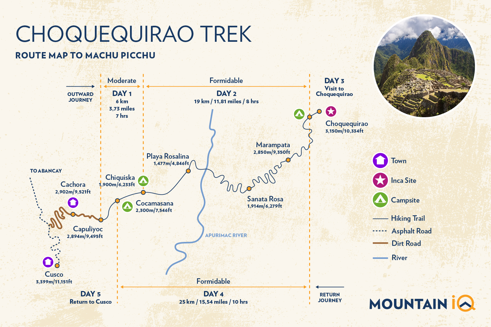
Below is our handy route map of the standalone Choquequirao trek. It outlines 5 days of hiking and gives brief details on the trail's varying level of difficulties and the distances covered.

Trekkers generally get a bus or private car from Cusco to Cachora (4–5-hour drive). From here, the route heads due north for two days to Choquequirao.
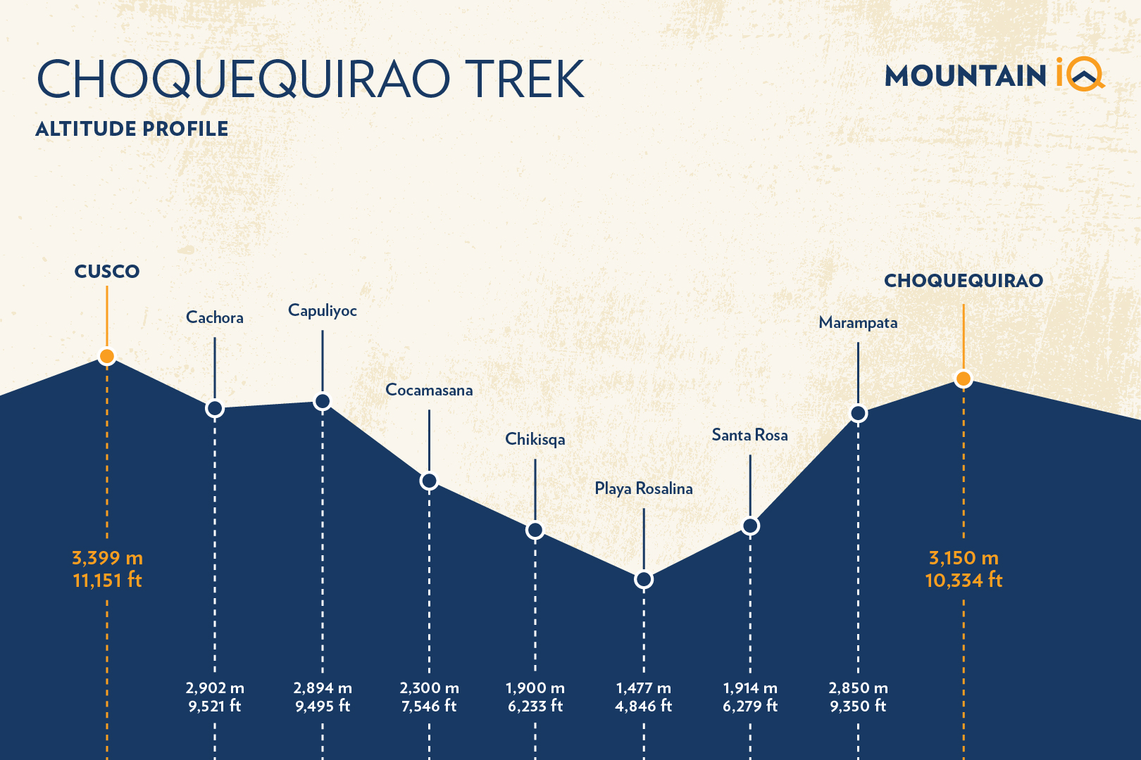
Below is the altitude profile for a typical Choquequirao trek. The highest point is Cusco (3,399m / 11,151 ft) and the highest camp on the trail is Cachora (2,902m / 9,521 ft).
Best Time for the Choquequirao Trek
The Choquequirao trek is impacted by subtropical weather patterns. These cycles dominate throughout the region. Two main seasons prevail:
- The dry season runs from late April through to early October.
- The wet season starts mid-October and runs through to mid/late April.
The best time to do a Choquequirao trek to Machu Picchu is between May and September.
Unlike the classic 4-day Inca Trail, which is bustling during this time, the trail via Choquequirao is mostly uncrowded. Do prepare for crowds in Machu Picchu though as this time of year is high tourist season.
The main weather concern while hiking Choquequirao will be the sun. Intensity is very high on many of the mountain slopes. Make sure to wear lots of sunscreen. Bring a good hat and use long-sleeve shirts to protect your forearms from burning.
The shoulder months to the dry season (April and October / November) are also a great time to trek.
The rainy months of December, January, and February are not great for trekking.
To read detailed historical Machu Picchu and Inca Trail weather information for each month of the year, check out our articles on:
Looking for a day tour? Here are my 5 favourite day tours around Cusco:
- Rainbow Mountain day trip (with meals)
- Moray and Salt Mines Quad Bike Tour
- Sacred Valley day tour
- Humantay Lake day tour
- Machu Picchu and Huayna Picchu entrance tickets
See more Cusco day trips.
How Much Does the Choquequirao Trek Cost?
For a 3 to 5-day, standalone trek to the Choquequirao Ruins, you can expect to pay around $400.
Understandably, the 9-day trek is much more expensive. For this, you will need to budget $1200 or even more. This will include your admission ticket to Machu Picchu.
Be wary of booking cheap tours. When you factor in food, mules, and staff salaries, it is difficult to reduce costs by much.
If the price is too good to be true, there are definitely hidden costs or lack of quality. We recommend you read our article on tipping policy and porter welfare.
You may also like:
How To Avoid Altitude Sickness on the Choquequirao Trek
The Choquequirao trek to Machu Picchu is one of the tougher Inca Trail alternative routes. This trail reaches a top altitude of 4,668 meters / 15,315 ft on the Yanama Pass.
It is advised that you spend at least two days in Cusco adjusting to the high altitude before beginning your trek. Most tour operators will organize hotels and excursions in Cusco. These days are important for acclimatization.
Cusco is unfortunately relatively high at 3,350m / 10,990 ft. You will undoubtedly start feeling the altitude as soon as you arrive. Try not to exert yourself whilst in Cusco and drink lots of water.
We encourage you to read our article on Machu Picchu Altitude Sickness for further details.

Get a trek quote
Start planning your trek to Machu Picchu today.
Choquequirao Packing List
The packing list for a Choquequirao trek is in fact very similar to the general Inca Trail packing list. The key difference is that the Choquequirao trek to Machu Picchu is much longer.
That’s why you need to bring additional clothing for the Choquequirao trek. Take extra pairs of socks as you’ll need a pair for each day. Also, remember to pack a few more trekking shirts and one more pair of trekking trousers.
For the rest of the required gear, everything stays the same as what’s recommended. For more information, look at this detailed Inca Trail packing list.
How Fit Do You Need to be for Choquequirao?
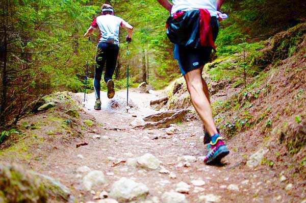
You will need to be in good shape to do the Choquequirao trek. This is particularly true if you plan on doing the 9-day version or any of the long combination trails. I wouldn't recommend these hikes for first-time trekkers.
In the months building up to your trek, I also recommend doing fitness training 4-5 days a week. This should mainly comprise cardiovascular exercises like running, swimming, or cycling.
You will also want to incorporate strength training and practice hiking with a backpack. Pick some trails with steep ascents near your home and go from there.
Read our Machu Picchu trek training program for more insights on preparing for the Choquequirao trek. Also see how to train for the Inca Trail.
Trekking Insurance For Choquequirao
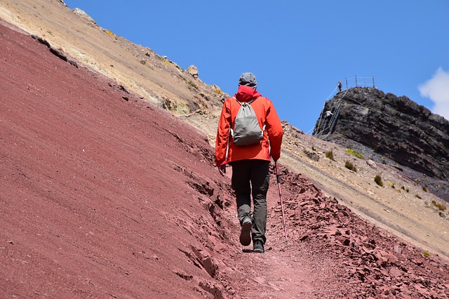
Insurance for your Choquequirao trek is a must. You don’t need to be worrying about ‘what-ifs’ while you prepare for your adventure. Most tour operators will require you to carry sufficient travel insurance for your trek.
As most trails to Machu Picchu go over high 4,000m (13,123 ft) passes, you will need to make sure your insurance covers you when hiking up to this elevation. Read the fine print or talk to a consultant to make sure you are covered.
I have reviewed a number of travel insurance providers and the most affordable and best by far is Rise and Shield.

Get a trek quote
Start planning your trek to Machu Picchu today.
Conclusion
If you have any unanswered questions on the Choquequirao trek, please leave a comment below and we will respond asap. If you have hiked any of the Choquequirao routes, we welcome any nuggets of wisdom and feedback.
Tags: Choquequirao Trek, Choquequirao Peru, Choquequirao to Machu Picchu, Choquequirao to Machu Picchu Trek, Choquequirao Hike, Choquequirao Map, Choquequirao Trek to Machu Picchu
References: (1) Wikipedia, (2) The Machu Picchu Guidebook, (3) Choquequirao trek to Machu Picchu

Hello Allison,
Thanks for your very informative blog. I and a friend, both of us slowish hikers aged 67, who nonetheless managed the GokyoLakes-Renjo La Pass trek in Nepal last October, are thinking to trek Choquequirao and Macchu Picchu later this year.
I am wondering whether the full tour of both sites, offered by several companies, would be best, or a different combination of shorter treks like the Vilcabamba-Choquequirao option. What would you suggest?
Can you suggest some operators who offer this, also local operators who offer the Choquiquirao-Macchu Picchu combination? The Humantay Lake also looks spectacular.
Thanks for your help.
Kind regards,
Virginia
Hi Virginia, If you have the time I recommend visiting both sites. In terms of operators you could try: Alpaca Expeditions, Wayki Treks, Peru Treks or Llama Path.
Is ot possible to do the trek on our own, without a guide? The Salkantay is a better option for an unguided hike: https://www.machupicchutrek.net/solo-salkantay-trek/
Yes, it is possible, but you will need to arrange transport to the trailhead. I recommend taking a guide as the trail is a little off the beaten path.